Sunday, January 9, 2011

Reed Islands and Inca’s


I thought that I had missed the chance to see the islands of Lake Titikaka, but the enforced move proved to be a blessing in some ways. The smaller reed islands are easily reached from Puno, and a thee hour tour let me see some of the images from the school books of my childhood up close and personal. It’s mainly for the tourists today that the people of the Islands dress up and either invite you in to look at their homes or even to stay overnight, but the reality is that they have been living there for thousands of years and it’s still a sight to see.


The Reed Islands & Boats


The Tuk Tuk's are back!!

The next target was the city of Cusco and from there the ancient Incan city of Machu Pichu. The hotel I had booked online had been overbooked and when I arrived they apologised profusely and arranged for another hotel for the first night free of charge. The next morning I met a couple of American lads, Doug and Eric, that had also suffered the same fate. The harp that Doug was carrying is another story, but after returning to our original hotel we then all caught a cab up to the top of the Mountain at the back of Cusco to the Incan ruins of Tambomanchay then walked all the way back to the city centre taking in three more sets of ruins on the way. I expected a walk, but not 10km!!


Cusco is a beautiful old city

The next day I had booked to go to see Machu Pichu. The cab was ready at 05.15 to take me to the rail station, where because of landslides that had blocked the track they were busing passengers to Ollantaytambo (a two hour ride) where we would then pick up the train to Machu Pichu. This is the only way to get there as private vehicles are not allowed. The ancient ruins are then another 30-minute ride up a very steep, very twisty, dirt road.


It's a long twisty road to the top

It’s a spectacular sight when you get to the top and see the extent of what was a huge city that the Inca’s built in the fourteenth century. The block work is so incredibly accurate that you can't slide a piece of paper between them, and there were no modern tools available to achieve this. The ride back started at 17.00 with the train and by the time I got back to Cusco it was 22.00. All in all a very long day, but worth it.


Perched on the top of the mountains


It was quite a sizable city


Built on some of the steepest mountains I've been in


Somehow it just doesn't seem right with the Christmas tree!

The next day was a long one too with a tour of the Sacred Valley. Visiting the towns of Pisac, Urabamba, and again Ollantaytambo. But the end I was pretty much all Inca’d out.


The terracing at Ollantaytambo


The Spanish even used some of the Inca stone work to build there Churches on

One thing to say in the defence of the Hotel. I don’t think I have ever encountered better service anywhere. The Torre Dorada not only is a comfortable place to stay, the staff go over and above what is necessary to make sure you have everything you need including giving you a mobile phone to call for one of the three cars any time of day or night.

One final day catching up on the final bits and pieces in the town and then it was on to Nazca. The road fro Cuzco to Nazca is 650km and I think there is about 20km of straight road in the lot!! On any normal day any part of this road would be a bikers dream. Good tarmac and switchback bends all the way up the mountains and all the way down. But when you are trying to get the distance done it was very hard work. Plus at one point over the Altiplano because I was that high and the storm hit, the rain turned to hail and settled. I was then trying to ride though two inches of ice on the road!!


Ice was the last thing I expected

I arrived in Nazca and after getting something to eat I fell immediately asleep and didn't wake up until the following morning. When I did I have been aching all over from the previous days ride, hard work.

Instead of paying $150 for a half hour joy flight over the Nazca Lines, myself and another couple caught the local bus out to a viewing platform to get a taste. The lines are an enigma, and there is no logical explanation. You always keep coming back to the visitors from outer space!! They are located in the middle of a very large, hot, dusty desert plane, about 10km north of the town.


Either the Frog or Hands in a tree depending on how you look at it


The lines are so straight and go for quite a distance. Why??

Wednesday, December 29, 2010

Christmas in La Paz and the Death Road

The Parador Santa Maria is an old 18th Century house that has been turned into a hotel, and very nice it is too. The town of Sucre itself is very laid back and very rich in the Spanish architecture that shows the history of the region to its best. Unfortunately for the first day I was there I got the first attack of gastro, which laid me up and made sure that I didn’t make it very far from the very nice bathroom I had!!


Main Square in Sucre


The hill at the back of town


Krusty burger anyone?


The View from the top floor of the hotel

While I was there the first rain fell, which made me ask some serious questions about the road to Cochabamba. It ‘s apparently 50% tarmac and 50% dirt which made me reconsider the wisdom of trying to achieve 350km in one day with it raining. I decided to backtrack to Potosi, and then through to Oruro, a hundred km further but all tarmac. One night in Oruro was enough, an old mining town where the mine has run out. If you’re coming this way I suggest you avoid it unless it’s a one-night stopover like me. So instead of spending Christmas in Cochabamba I ended up spending it in La Paz.

La Paz is huge, I came in “the back way” from the top of the mountain, but the traffic soon started to live up to its reputation, the last 20 km took me two hours to do. There are hundreds of small vans that act as buses around the city. They all stop as and when they want so it seems and the resulting traffic jams is a nightmare!! They all use the horn to signal their presence, so the cacophony of tooting is ever present (like India) Apart from that because its built on the side of a mountain it doesn’t seem to have a centre, or heart of the city. Christmas trees and decorations were everywhere and the children were just as excited as anywhere else in the world.


The Christmas Eve market in La Paz


The women don't wear this dress for the tourists


The flowers street was very popular

With Christmas day over I decided to try to book one of the bicycle tours of the “Death Road” that are run by many companies in La Paz. After searching I found one that looked “professional” enough, but they didn’t think they would have enough people to run the tour on the Sunday. After hearing nothing I decided to get the Wombat out, rain or shine, and go to find the road myself. On the road to Coroico 54km north east of La Paz there is a turning to the right, just past the crest of a hill. I 'stoped there initially, but couldn't decide if it was the right place and carried on for another 20km until I asked a woman at the side of the road where the Camino de Muerte was? She indicated it was back the way I had come and at the top of the mountain. When I arrived back at the original spot, a family had stopped to take photos and confirmed that yes this was the start of the death road, and felt confident that I would be able to make it on the bike. I decided that would start down the hill, and if it was bad then I would turn around, at least being able to say that I had ridden some of it. I kept going. Half way down there had been a landslide and a van with some Colombian tourists were stuck, trying to decide that if they turned around they would meet anything else coming down!! I told them there were some cyclists on their way, but I didn’t know if the support vehicles were going to follow them. Their driver seemed to think I’d have no problem getting over the pile of earth that was blocking the way, so I turned on the video and gave it a go. It was softer than I thought, and when the back wheel started to spin and slide towards the edge, I thought I was going to be in trouble. The van driver and his passenger managed to keep me on track and I finally made it across. There was no more traffic until I reached the end, where the support vehicles for the cycling tours had obviously taken the alternative (new) road to collect their charges.


No room for mistakes


I left La Paz the next morning, a little sore after the exercise of the previous day, but satisfied that I’d done one of the things on the bucket list. The ride out of the city was very easy, and I thought that I’d wait until I reached the outskirts before filling with fuel. But each gas station that I passed had a very large que outside, and it wasn’t until I stopped at one of the last stations that the policeman that was there told me there was no gasoline and I would have to go back to one that did have some. It turned out that overnight the government had put the price of petrol up by 83% and the price of diesel up by 76% there are now transport strikes everywhere. I did get fuel, and cheekily pushed my way to the front of the que to get it. It was then a short ride through to Copacabana on the shores of Lake Titikaka.

It was then a short ride through to Copacabana on the shores of Lake Titikaka.


From my limited Spanish this was where they built the Kontiki Rafts


The South end of Lake Titikaka


The view from the hotel window

Unfortunately they could only give me one nights accommodation, and the next morning when we tried to find another couple of nights in another Hotel they were all booked up too. So the decision was made for me that I should move on round the lake and into Peru.

Tuesday, December 21, 2010

Into Bolivia

The plan was to leave San Pedro and get to the border at around 12.30 leaving about four or five hours to cover the last 200km into Uyuni. Well that was the plan. The last 100km to the border on the Chilean side is dirt road, and not very good at that. 


The Bolivian border

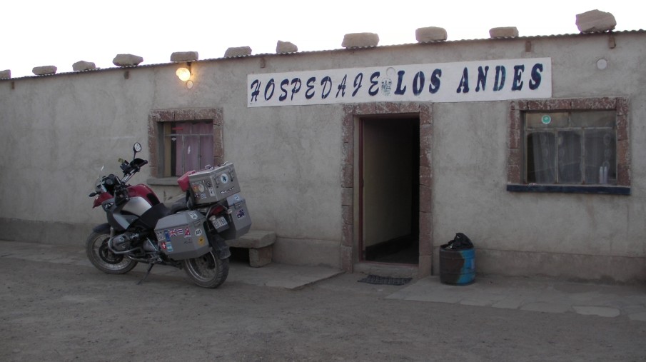
So I arrived at the border at three o’clock and departed Chile no problem in about 15 minutes. Then I rode the 2km to the Bolivian border. It was four thirty when I finally got the importation papers for the bike stamped and I was able to continue. The next 70km took me three hours! It’s some of the worst road I think I have ever taken the Wombat onto. Loose gravel, dust, and patches of sand all came at me without warning or rhythm. A strong tail wind and reasonable temperature kept the motor temperature on the maximum for the whole time and luckily the average speed was low enough to give me very good fuel consumption, because there was nowhere in sight to get fuel (why hadn’t I filled the spare container??) So when the first small village came into sight and there was a picture of a bed on one of the signposts, I thought that would do for the night. $7 bought me a bed, a shower and a good hot meal, in one of the poorest looking places I think I have seen. But I was really thankful for it.


The First nights Hotel for $7


The Village in the morning


The local brick works


Villa Alota village square


Down onto the first small Salar. The signpost is for mines either side of the road!!

I set off again the next morning at what I thought was 08.30. In reality it was 07.30 as the clock should have gone back an hour when I crossed the border! I spoke to three Argentinean lads on various 650’s going towards the border, and they confirmed my fears that the road did not get any better before Uyuni. So the next 130km was a bone-rattling ride with the last 50km consisting of the worst corrugations I have come across. I seriously had a good look at the Wombat the next day to make sure nothing had broken.


Scenery good, road bad!!

Uyuni has one thing going for it, it’s next to the Salar. If not for that then nobody would go there. I booked a tour the next day with one of the many companies in town. I didn’t want to do the three day excursion which most of the backpackers do, I figured two days and one night was as much as I needed.


Uyuni


The train graveyard


The Salar is a spectacular sight. It’s the larges salt flat in the world, followed by Utah, and the Salar de Atacama. Fleets of land cruisers head out every day, and usually end up in the same place at the same time. The only way to have it any different is to use your own transport. If I had been with someone else, or if I had the knowledge I have now I would have done it, but I don’t think it’s the place for taking chances. The overnight accommodation was interesting. A hostel made entirely out of salt, but no showers and beds that would make a door look comfortable. I was the only one that got up to see the sunset out of our party, although there were two Argentineans that had arrived the night before in their own car, and had been there before, set off to see the sun rise over the salt. A visit to the island Incahuasi, which is a coral island in the middle of the salt flats, not only gives you some magnificent views of the flats, but also is covered in Cactus.


The Salar De Uyuni


The Volcano


Flamingo's at dawn


Overnight accommodation in the Salt Hostel


The Hostel on the edge of the Salar


Dawn on the Salar


Incahausi Island


One more night in Uyuni to recover and get clean before heading out for Potosi. The road is about 70% tarmac and 30% dirt. They have obviously been working hard recently to complete the valley sections of the road which is now very nice smooth tarmac, until you come to the hills which are still dirt and in places soft sand.


They're working on it


The down side is that people will miss this when the road is done

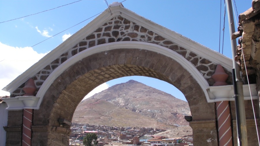
Potosi is one of the highest cities in the world at 4000m. Perched on the slops of the hill that contains the Cero Rico mine, and has brought prosperity to the place since the 15th Century. When the Spanish arrived the spirits had already told the locals, that the silver in the mountain was not for them but for strangers that would come from far away. There was little opposition to the Spanish who then started to mine, and process the silver here. Pieces of eight

Were sent from here to the Spanish Main to be transported to Spain with the Privateers and Pirates waiting to try to stop them. The mint today is a museum, which gives a fascinating insight into how important a place this was. The other main tourist attraction is to visit the co-operative mines that still work the hill behind the city. I passed on that. The elevation combined with the potential danger of visiting what can only be described as sub standard working conditions at best, to see people working there way to an early grave did not appeal.


Potosi


Cero Rico Mountain


The Old Mint

So after two nights I headed out again for Sucre, and the promise of tarmac all the way.